Description
After the successful redevelopment of the Essex Highways a number of years ago the website and underlying platform was in need of a refresh.
This was done by way of a web-based application combined with our underlying CMS:42 product. The basic website information and news pages can be managed through CMS:42 just like any other website. But new modules were created so the admin users at Essex Highways can create bespoke user journeys on the fly, which will capture information and present a solution to the resident using the app.
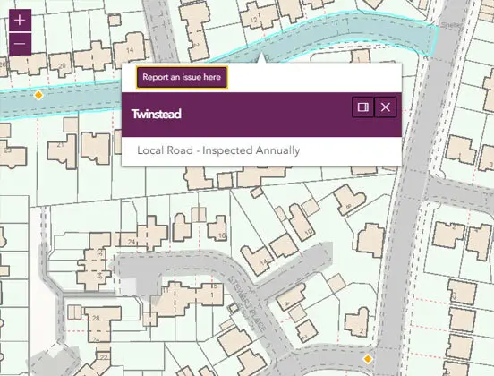
A stand-out feature of the new website is integration with ArcGIS mapping software as well as Essex Highway's Asset Management platform.
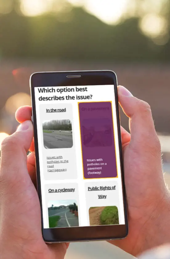
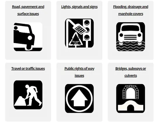
Residents can report issues with pavements, roads, signs, lighting, bus-stops, bridges or any other road or transport related topic. Through a guided set of questions, the data captured can be formatted to match the required fields for the database and fed directly into the council’s own software. Integration with mapping tools allows a user to pinpoint the site of an issue and track other issues already plotted on the map. Emails and notifications are triggered as required and the whole thing is not only responsive for tablet and phone users, but has also had to meet strict accessibly guidelines so that any user relying on screen readers or unable to use a mouse or traditional pointing device will still have full access to all features of the tool.

After the successful redevelopment of the Essex Highways a number of years ago the website and underlying platform was in need of a refresh.
This was done by way of a web-based application combined with our underlying CMS:42 product. The basic website information and news pages can be managed through CMS:42 just like any other website. But new modules were created so the admin users at Essex Highways can create bespoke user journeys on the fly, which will capture information and present a solution to the resident using the app.
A stand-out feature of the new website is integration with ArcGIS mapping software as well as Essex Highway's Asset Management platform.
Residents can report issues with pavements, roads, signs, lighting, bus-stops, bridges or any other road or transport related topic. Through a guided set of questions, the data captured can be formatted to match the required fields for the database and fed directly into the council’s own software. Integration with mapping tools allows a user to pinpoint the site of an issue and track other issues already plotted on the map. Emails and notifications are triggered as required and the whole thing is not only responsive for tablet and phone users, but has also had to meet strict accessibly guidelines so that any user relying on screen readers or unable to use a mouse or traditional pointing device will still have full access to all features of the tool.
Ready to talk?
Impressed by what you have seen, want to know more? Perhaps you would like to meet in person... coffee is on us!
Get in touch